

**Results of the 17th Urban and Architecture Joint Committee Meeting**
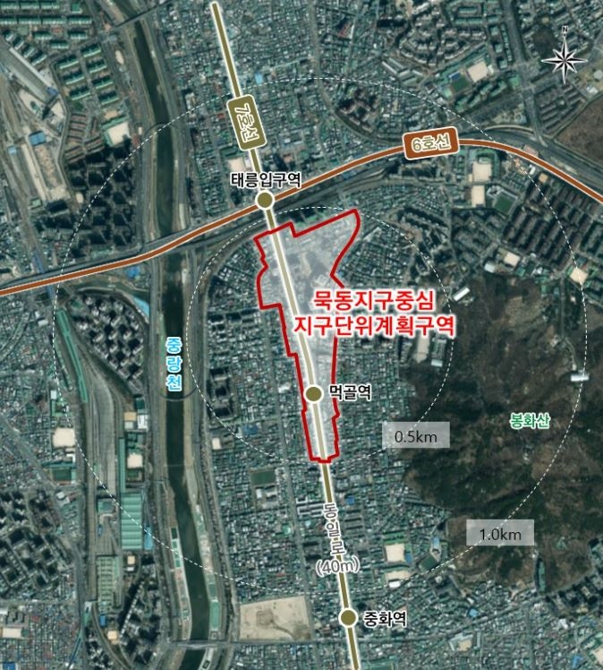
*Location map of the Muk-dong District Center Zoning Area [Provided by Seoul City]*
[Herald Economy=Reporter Park Ro-myung] The Seoul Metropolitan Government will reorganize the district unit plan for the first time in 17 years since the decision notice of the Myeonmok District Center zone plan in 2007. The plan is to strengthen the district’s centrality by expanding the area.
Seoul City announced on the 12th that it had revised and approved the proposal for the ‘Myeonmok District Center zone unit plan area and decision’ at the 17th Urban and Architecture Joint Committee meeting held on the 11th.
This area covers 207,936 square meters. It features excellent public transportation accessibility with Subway Line 7’s Meokgol Station to the south and Subway Lines 6 and 7’s Taereung Station to the north, centered around the main thoroughfare, Dongil-ro. It is a region with development potential as a commercial and business center located along the northeast development axis.
The modification of the district unit plan is a reorganization after 17 years, considering changes in conditions surrounding the area since the 2007 decision notice. The expansion of the area aims to induce balanced development along Dongil-ro and reinforce the district’s centrality through planned management of the station area. To achieve this, five special planning districts were newly established.
Especially in the special planning districts, the plan is to enhance lacking community social overhead capital (SOC) facilities by contributing cultural and welfare facilities to the public. The Mook 2-dong area along the main road, which was excluded from the detailed plan in the past, is included in this zoning area. It is expected to contribute to resolving regional disparities with Mook 1-dong through the planned management of the main roadside.